Springbrook Waskasoo
 
Springbrook Waskasoo Life header
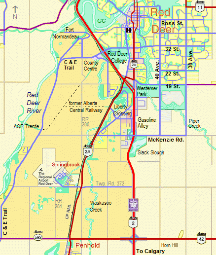
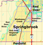
Springbrook Alberta, Red Deer Regional Airport, Waskasoo Watershed, Gasoline Alley
 
Home Coming Events Directory Maps History

Springbrook Waskasoo

Springbrook Streets

Springbrook Land Use

Residential Development

Former Mynarski Park

Division 3 Red Deer County

Historic Calgary
& Edmonton Trail


Springbrook Waskasoo

map of Springbrook Waskasoo
Springbrook Waskasoo includes the area north-south from Red Deer to Penhold and
east-west from the Red Deer River to Highway QE2, including the hamlet of Springbrook,
Red Deer Airport, the former CFB Penhold, Gasoline Alley West, future Liberty Crossing,
Fort Normandeau, the former CPR/ACR Mintlaw trestle and Red Deer County Centre.
 
Major north-south corridors include Canadian Pacific Railway, Highway 2A,
historic C & E Trail, Highway QE2, Red Deer River and the future Trans Canada Trail.

       
Proposed Springbrook Heritage Urban Design Plan 2007
Aerial Photos of Springbrook - Fall 2007


bold vision
for
a visitor destination with
4 unique attractions
featuring a ground transportation theme


Forth Junction Heritage Society
within a proposed family trail, rail and transit activity and heritage park
 
Forth Junction Project


CARTS logo
Central Alberta
Regional Trails Society

 
Coming Events  |  Directory  |  Maps  |  History
CFB Penhold  |  B.C.A.T.P.  |  Andrew Mynarski  |  Trails  |  C & E Trail  |  Rail History  |  C & E Railway  |  Alberta Central Railway  |  The Future